One word: Epic
I could leave it there and justice would be served, but there is already a shortage of trip reports for this route so I’ll go into the full diatribe.
Day 0, Thursday, a drive down after work meet up with fellow WACers and all-around awesome peeps Parker and Dave and grab some Pizza. We saved enough for breakfast the next day which was worth it. Mmm, pre-climb cold pizza. We drove to the White River camp ground, parked Dave’s car, then headed out to the Carbon River Ranger Station so Parker and I could get our climbing permits first thing in the morning. We pitched our tents right in front of the ranger station, but the ranger must have forgot his condoms in his other brown, wool, boy-scout pants cause he showed up after-hours at the station, kicked us off the lawn, and onto a proper site down the road, then abruptly left back the way he came.
Day 1, Friday, we wake up and start packing up our things waiting for the ranger to show up. I put my keys safely in a zipper in my pack, put all the packs in the trunk then realize that I need my keys to drive and have no way to get into the trunk to get them. Awesome. Fortunately Parker has long arms and was able to reach in through a speaker hole and move the packs around enough so that my short arms could pull the keys out. By now the ranger is there so we head over to get our permits. Insert problem #2. No one in their right mind climbs Rainier from Mowich Lake, certainly no one in their right mind does so for their first climb of the season, so the ranger is not prepared to issue climbing permits. He has one left, but the computer is locked up. If I remember right, he said he has only issued 3 permits total over the last 6 years. Awesome. Thankfully he was a really stand-up guy and worked over the phone with one of the other ranger stations to get the data in the computer. He could have just as easily said f-off and made us wait for the next ranger or go to another station. Really appreciate the help bro! After the best part of an hour Parker and I both have our temp permits and we’re off to the Mowich Lake campground.
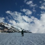
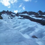
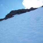
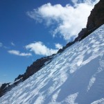
After all the delays it’s 10:30 by the time we hit the trail. No time to smell the roses so we get cracking. The trail starts with a 500′ or so decent that you have to make back up to gain the meadows. While in the woods though, there is a marked look-out point 50′ or so below the trail. I strongly suggest stopping at this look-out. Not only is it a perfect view of the mountain, but the first time you can get a really good look at the North Mowich and Edmunds Glaciers to plot a route. At the top there is a beautiful alpine meadow and you follow the trail through it for a while before breaking off and going cross-country to Ptarmagan Ridge. Supposedly there is a boot path further up the trail to the regular accent and drop-down point for the ridge, but the upper glacier was fully out by this point and we needed to drop down on the glacier someplace lower. We met a back-country skier taking some turns down perfect slopes on the north side of the ridge. If I were a back-country kinda guy, I’d put it on my short list of places to go. Looked awesome.
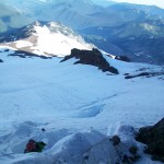
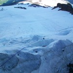
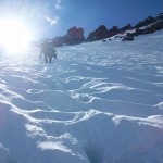
We took the ridge and noticed we were far to low to descend onto the glacier, so we hiked up the ridge a few hundred feet and took a lunch break. Dave found adiquate-looking shoots for descending the ridge and we rock-skied down on our boots to the flatter snow just above the glacier. Parker had not put on his gaiters yet and ended up with massive amounts of earth in his boots. We roped up and then started a traverse up the lower part of the ridge to the part of the glacier we needed to start our route. This is where arguably the worst incident of the trip happened. With some faster movers on the rope with me, I ended up with a little tug and lost my balance on the rock face. Fortunately I was able to turn my pack into the first boulder, and then roll the second with my ice axe, the third crashed straight into my shoulder though and one of the toaster-oven sized rocks that came with my crashed into my ribs. When I fell I thought for sure I was going to break a leg or something critical but was lucky enough to escape with some big bruises, a few medium-sized cuts, and a pair of seriously ringing ears from the adrenaline rush! After a moment or two to make sure I was still in one piece and to send a giant thank-you upwards, we continued on to the glacier. We had an easy enough route picked out up a ridge, over some earth and rocks, below a horn, up a chute, over a slope between two hills, and onto the high-camp. As we had such a late start we opted to camp at the lowest of the high-camps somewhere around 8500′ I think.
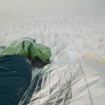
I cooked up some really delicious tuna ramen, Dave tracked down some running water, and Parker got to work setting up the bivy. It had been around a 9.5/10 hour day at this point and dinner was delicious even if I was still recovering from a monster flu from the week before and didn’t have much appetite. That night we had a major thunderstorm and thought a few times about moving the camp but the lightning never got close enough to us to scare us enough to go outside in the combo downpoor and 50mph winds. The next morning we found the entire inside of the tent Dave and I shared, the gear under both vestibules, and everything in my bivy bag (that Parker was using) to be bone dry. What a testament to modern tents!
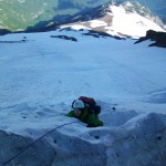
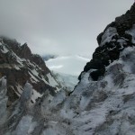
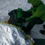
Day 2, Saturday, pack bags, make oatmeal, and get on the move by 5am. By the time the sun was up we were at the bergschrund which was a fun little problem. Dave led with me keeping him on a tight rope. Once he made the headwall on the far side he belayed Parker and I up. At this point it was time to start the torture. 45 degrees of soft snow meant not only going slow because it’s hard, but even slower because kicking steps was almost impossible. It took somewhere around 8 hours to make it up the snowy first section and then it was on to harder things. The top of the Edmonds Headwall is a roughly 60-degree traverse then climb over a solid sheet of ice. We roped up and Dave led our running belay putting in ice screws every 100′. I can’t imagine doing this section of the climb without protection. A single slip and it would have been impossible to arrest before dropping several hundred feet down the cliff and then into a monster crevasse. At least one ice tool would have been really helpful here, but the three of us managed it with using two alpine axes a piece. This is also where tragedy#2 happened as Parker had a slip, slammed into the wall, and knocked the two-man tent loose. Dave and I simultaneously spit out a “oh, shit” while Parker, being the most forward-thinking, simply states, “Let’s just make sure that doesn’t happen to one of us.”
The ice climbing is methodical, but slow and massively hard work. We only had 4 screws so Dave needs to belay us up to him every 300 feet. Some of the screws were having problems with ice jamming in them too which slowed everything down. In the end it took about 6 hours to make it to the top and by that time my right knee was completely numb from banging into the ice to keep my weight over my crampons. At this point it was 9pm and we had a one-man bivy, a one-man space bag, and a one-man space blanket between us for shelter. We took the first decent camp we could find which happened to be a small valley at the top of the headwall covered in wind-eroded ice stalagmites. The three of us pulled out our axes and shovel and chopped down enough of them to make a small space to camp. As I had the best sleeping bag, I ended up in the space bag while Dave and Parker tried to find a way to squeeze into the bivy together. None of us got much sleep that night, but we did survive, which is what you prepare for.
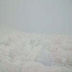
Day 3, Sunday, the sleep was so poor, and we had had such a long two days that none of us got moving until 8am. I melted enough snow for each of us to have ~.75 liters and then we needed to get going. The ridge we followed on the Liberty Glacier was entirely populated with those horrible ice stalagmites (or fucyous as I began to call them). Being my first trip up Rainier, one of the most impressive things was how amazingly large the summit area is. What we thought would be a short march to Liberty Cap was an unending, multi-hour, death march, of hill after hill after hill of fucyous. After it seemed it would never end we finally made it to the cap and had a look over at the summit! A super short down-climb followed by an irritating up-climb on two-step-forwards-one-step-back pebbles and dirt got us to the summit ridge, from there it was a short hike to the register and then to the summit. We split up the few remaining swallows of water we had left (this is no exaggeration, we were measuring water in swallows at this point) and started down the Emmons cattle track. It was 1pm by this point and we didn’t have time to break out the pot and boil water. We did however run into fellow WAC classer Genevieve on the summit. You go girl, I’m guessing you were on tons of Diamox.
I led the way down and at about 12,000 feet ran into a super sketchy snow bridge over a crevasse. Parker keeps the rope tight as I try to ease over the bridge but it’s only three inches thick of melting snow and collapses anyway. I only dropped about two inches into the crevasse and was able to use my axe to pull myself to the other side. Parker and I tried for a while to find a different bridge down, but with no luck and he and Dave end up jumping the 3.5′ gap. At this point a team that had just gone rocket speed up Liberty Ridge passed us (YO! Who does Liberty Ridge at the end of July??! My hat’s off to you three!) and glissaded down. We followed suit and glissaded behind them in their tracks. What a break. Not only did we get a perfect glissade track but also could follow their lead on when to stop to jump the remaining crevasses. Huge time saver. I love you guys!
By 6pm we were at Camp Sherman and chatting with some of the peeps there about the condition of the Inter Glacier. They said it was in super shape and we were fine glissading down the whole thing. We warned a team going up the Emmons the next day that they were going to have to figure out a way to skirt the collapsed snow bridge and headed off for the Inter Glacier. Just before the glacier we found some running water and each of us chugged about a whole liter. At this point we were still following the Liberty Ridge team and taking their glissade tracks. I ended up cramping the badly in both my legs which made the glissading slow, but we ended up sliding down over a 1000′ of snow that day. Seriously awesome (not to mention the hours it shaved off our trip if we had to walk it down).
The new trail down to White River was finished and we flew the final five miles back to the car. We chatted with some silver-beards who had just climbed the Emmons and then headed off for McDonalds and a far-far-far-too-long car ride home. I think we left Mowich Lake where my car was parked at 12:30am. By FAR the longest, highest, farthest, most-dangerous, bitchinest, raddest, most painful, adjectivest climb I’ve ever done. Gluttons for punishment only for this route. Totally worth it.
Check out the pictures!
A link to Dave’s report
-
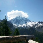
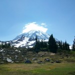
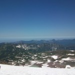
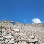
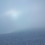
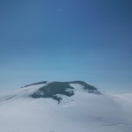
- View from the lookout on the trail
-
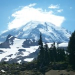
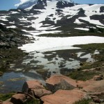
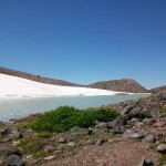
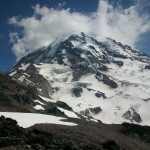
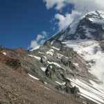
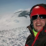
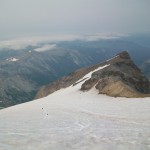
- Doesn’t get better than this
-
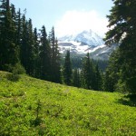
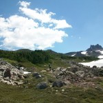
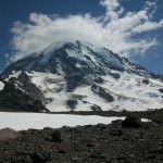
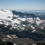
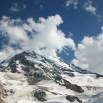
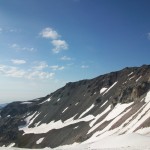
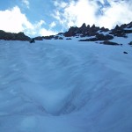
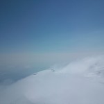
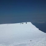
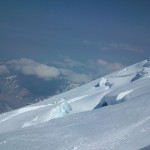
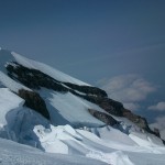
- Ptarmigin Ridge and Mr. Rainier
-
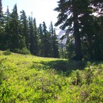
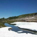
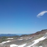
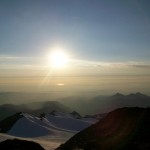
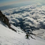
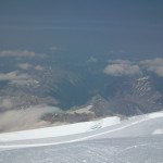
- Reflections…
-
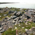
- This cool lake was right at head-level which was a really awesome affect
-
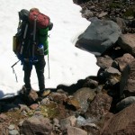
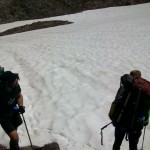
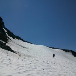
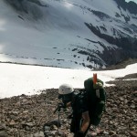
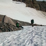
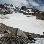
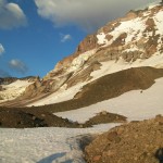
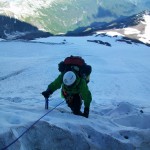
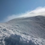
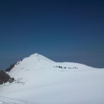
- Gaining the ridge
-
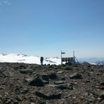
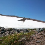
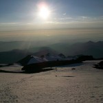
- A solar-powered something. Camera? Weather station? Moon laser?
-
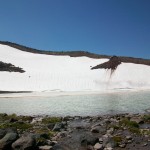
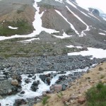
- A huge water fall
-
- And another
-
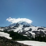
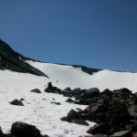
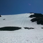
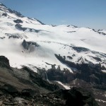
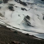
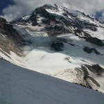
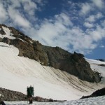
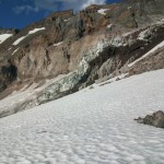
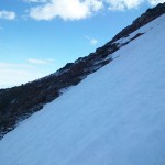
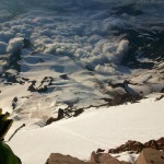
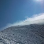
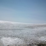
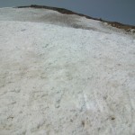
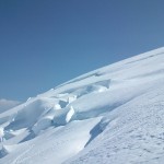
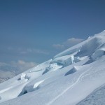
- The upper route is out. North Mowich Glacier does not look in good shape
-
- Dave shows us how the pros slide down a talus field
-
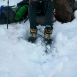
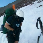
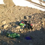
- Parker dumps his boots. Shoulda worn gaiters dude!
-
- Well, I guess lunch is over
-
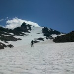
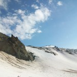
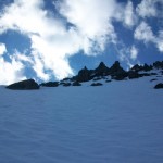
- We decided on a route up the chute to the right
-
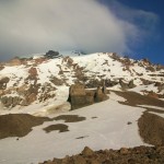
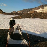
- Descending to a possible camp at sunset
-

- Day 1 in red, day 2 in blue
-
- Wake up and cook me dinner!
-
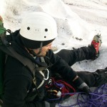
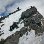
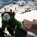
- Day 2, Dave belays Parker up the schrund
-
- Parker joins us at the top of the burgschrund
-
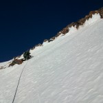
- That looks steep
-
- Stairway to Heaven
-
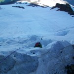
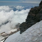
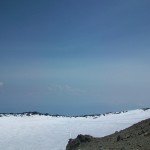
- A peak at the summit mound from the top of the headwall
-
- Dave puts in a much needed ice screw during the traverse
-
- We lost the tent in the crevasse below
-
- Gunna agree with Parker. Let’s not follow the tent down that slope
-
- Our camp, cut amongst the fucyous
-
- Morning?? You call this morning?!
-
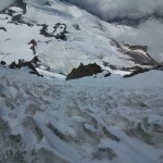
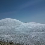
- Hill after hill after hill after hill of fucyous on the Liberty Glacier
-
- Summit photo on Liberty Cap with the summit mound in the background
-
- A look back at Liberty Cap
-
- The old crater
-
- The new crater
-
- For you Meghan!
-
- For you Graham!
-
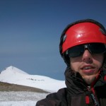
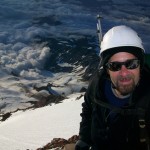
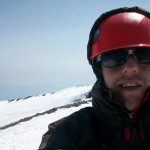
- Summit photos
-
- Starting our descent on the Emmons
-
- The Liberty Ridge threesome continuing to clear us a glisade trail down the Inter Glacier. Thanks guys (and girl)!
-
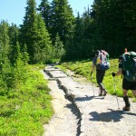
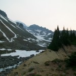
- The trail out to White River
-
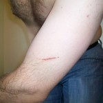
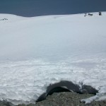
- Manly scars
-
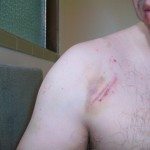
- That’s where my shoulder hit the rock during my fall on Day 1
-
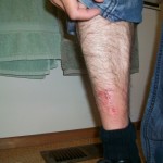
- That’s where my shin hit my boots all weekend
-
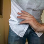
- Even finger wounds were epic. That one on the ring-finger was almost down to the bone.
Comments are closed